Using Geographical Maps to Trace Family History

Maps are very useful to a genealogist. Guides to parish boundaries, land ownership, railways and cemeteries are the kind of maps that are invaluable to anyone delving seriously into family history.
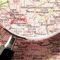
Your Ancesters and Old Ordnance Survey Maps
Anyone who's done any hiking or serious geographical study will be familiar with Ordnance Survey (OS) maps. They were initially part of a defence project during the Napoleonic Wars to survey the British countryside, begun in 1794, but took on a life of their own as the definitive maps of the country.In addition to displaying road and topographical features, maps often identify farms and structures by name. But these days they don't have the detail of the older maps, which were exquisitely elaborate. Thankfully, you can find many of the older ones in reproductions, or in county record office, libraries and second-hand book shops. If you have an old address that's no longer on newer maps (the area might have been demolished), then old OS maps will show you what you need to know. You can find Ordnance Survey, but not the old maps, online.
Manuscript Estate Maps
Manuscript estate maps detail the physical layout of buildings and fields (with names!) on a particular estate. They're of great use in pinpointing boundaries and identifying structures, which might be relatively unaltered over the centuries. Some of the maps date from the 17th century, with a single map showing an individual property, whilst a complete volume documents an entire estate. You'll even find lanes, bridle paths and fords.Some maps are closely associated with reference books where you can find listings of owners, tenants and holdings, along with acreage. The repositories are generally in country records offices, although the British Library is a good source, along with the National Library of Scotland.
Tithe Maps
For locating a parish (particularly one that might no longer exist) and its boundaries, tithe maps are ideal. They mostly date from 1837-1850, and were made so parishes could know where to collect tithes.A tithe was a sum, literally one-tenth, part of a person's income that was paid to the church. The custom dated back to the early Middle Ages, when it became a large part of church income.A tithe map survey was undertaken by the British government, a project to map all titheable lands, after which a monetary tax was imposed on landowners - tithes had generally been paid in goods and produce.
A tithe award was the document that recorded the amount of the rent, and listed the name of the landowner, as well as those who farmed the land and occupied it. These generally accompanied the map. You can find the maps in the National Archives and the National Library of Wales.
- Genealogy and a Criminal Past
- How to Deal With Conflicting Dates in Genealogy.
- Tracing the Female Line in your Ancestry
- How to Use Obituaries for Study
- Taking a Genealogy Course
- What's at the National Archive?
- Using the International Genealogical Index
- Using Local Libraries as Sources
- How Do You Know When You've Really Hit a Dead End?
- The Increase in Online Genealogical Resources
- Researching British Genealogy from Abroad
- The Importance of the 1911 Census
- Do You Need a Professional Genealogist?
- Latin In Church and Legal Records
- The Family Bible In Genealogy
- Genealogy And Military Records
- How To Find And Use Medieval Genealogy Information
- The Importance of the Protestation in Genealogy
- Checking Taxation Records for Family History Research
- Sharing The Results Of Your Genealogy Research
- Using Criminal Records For Family History Research
- How Museum Collections Can Help You In Genealogy
- Poor Law Records and Tracing Your Family Tree
- Surname Variations When Tracing Your Family Tree
- Tracing Ancestors Transported to the Colonies as Criminals
- Tracing Family History On The Female Side
- Using The Internet to Trace Your Ancestors
- Utilising Local History To Research Your Family Tree
- Genealogy and Medical Records

Re: Using Criminal Records For Family History Research
Trying to find dads past history with arrests just out of interest as hes recently passed away and…
Re: Using Criminal Records For Family History Research
Hi all i wanted to find out about my dad's past and nobody seems to know much about it or what he did.…
Re: Maiden Names in Genealogy
Looking for my fathers mother maiden name
Re: Genealogy and a Criminal Past
I am trying to find out about my father crime in 1992 or 1993 my father as pass away 1998 and I would like to find out why he got…
Re: Using Criminal Records For Family History Research
I am trying to find my biological father's police criminal record as I was abused as a child but have…
Re: Cremation Records and Tracing Your Family History
I am trying to find out where has my friends aunt Adelinda Diaz McMullen was cremated and who was her…
Re: Cremation Records and Tracing Your Family History
CAN SOMEONE PLEASE HELP ME WITH TRYING TO FIND OUT WHERE MY FATHER WAS CREMATED/BURIED IN KENT UK. I…
Re: What If You Have Asian Roots?
Ancestor Edward Albert Wells was born in Trichinopoly on 8 May 1833 to his father George Wells of the 54th Regiment at Foot and…
Re: How to Use Church Marriage Records to Trace Your Ancestors
It is still legal for first cousins to marry.
Re: Cremation Records and Tracing Your Family History
My sister finance was cremation and she stayed up by his bedside at Augusta university for days on out…